Monday, November 14, 2005

The Superstition Ridgeline

Saturday, November 12th myself and a group of friends set out to do the Superstition Ridgeline trail. The total distance is a little over 10 miles, but can feel like much more.

The first time I did this trail was 2 years ago and it took a group of about 12 of us 12+ hours to finish. We hit the trailhead at 5:30 am; I was the first one down from the trail and I walked to my car at close to 6:00 pm. I was one of the only ones to make it out while we still had sunlight. The bulk of the group finished the trail in the dark. As you look at the pictures (or if you've ever been on the Flatiron/Siphon Draw trail) - you'll see (or know) that's not a good idea. Also, it was mid October and hotter than blazes (I think it got over 100 that day).

This time around things were much different. We had a group of 14 of us going across east to west, and another group of 5 going west to east (It's definitely a one-way trip so we shuttle cars and/or exchange car keys on the trail). We hit the trailhead at 7:00 - which was some cause for concern. As I said, the last time we did this it took 12 hours, so we were thinking we would have to make some serious time on the trail to avoid having to hike in the dark. I'm normally a very strong and fast hiker, so I took off with the advance group (5 of us - cutting a wicked pace).

I needn't have worried about making time up. We were being led by a gentleman named Steve who's reported normal time across the trail is 5 hours. Dude is a freaking machine. We finished in just over 7 hours. From all reports the rest of the group were down from the trail by 5:00 or so - about 2 hours behind us. A far cry from the 12+ hours it took us 2 years ago.

The day was just spectacular. The sky was clear, it was cool (I think it may have hit 80 or so) and there was just enough of a breeze to cool you off quickly if you stopped (which we didn't do a lot).

Overall a fantastic day of hiking.

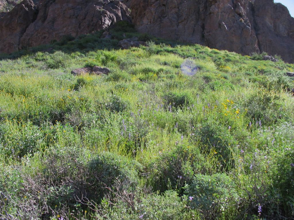
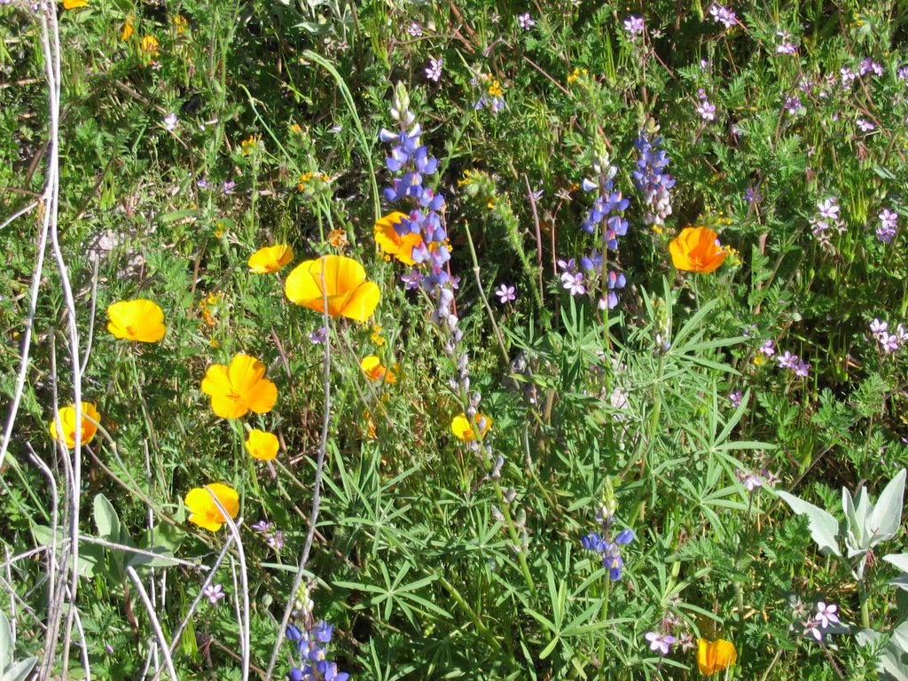
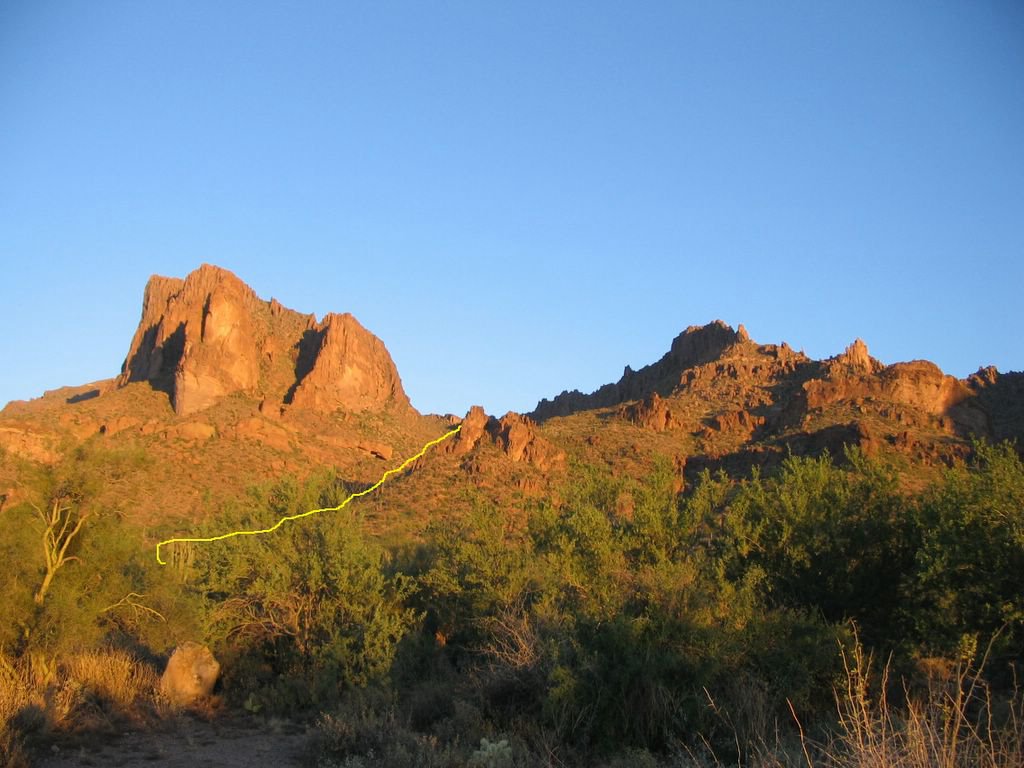
The following pictures don't nearly do justice to the scale of the hike, and in fact the distances as they appear in the pictures are a little deceiving - it is truly a long hike. I have also added a tracer to show approximately the route of the trail - it disappears as it goes behind objects.

For those who have read earlier posts, I've changed format and am now putting the captions for the photos above the pictures. Based on the way that Blogger.com formats stuff, it just looks better that way (in my opinion).

Below is a shot from where we parked our cars at the Carney Springs trailhead - it's about 7:00 am.
After an insane ascent - truly, you have no idea - you reach the first saddle and get this view looking back eastward. The cars down at the bottom are actually campers that were near the trailhead, but we were only about 1/4 mile to the south and west of them around the face of the cliff in the picture.

This shot is looking west toward Superstition peak from that same saddle. That's NOT the halfway point either - more like the 1/3 point of the hike.

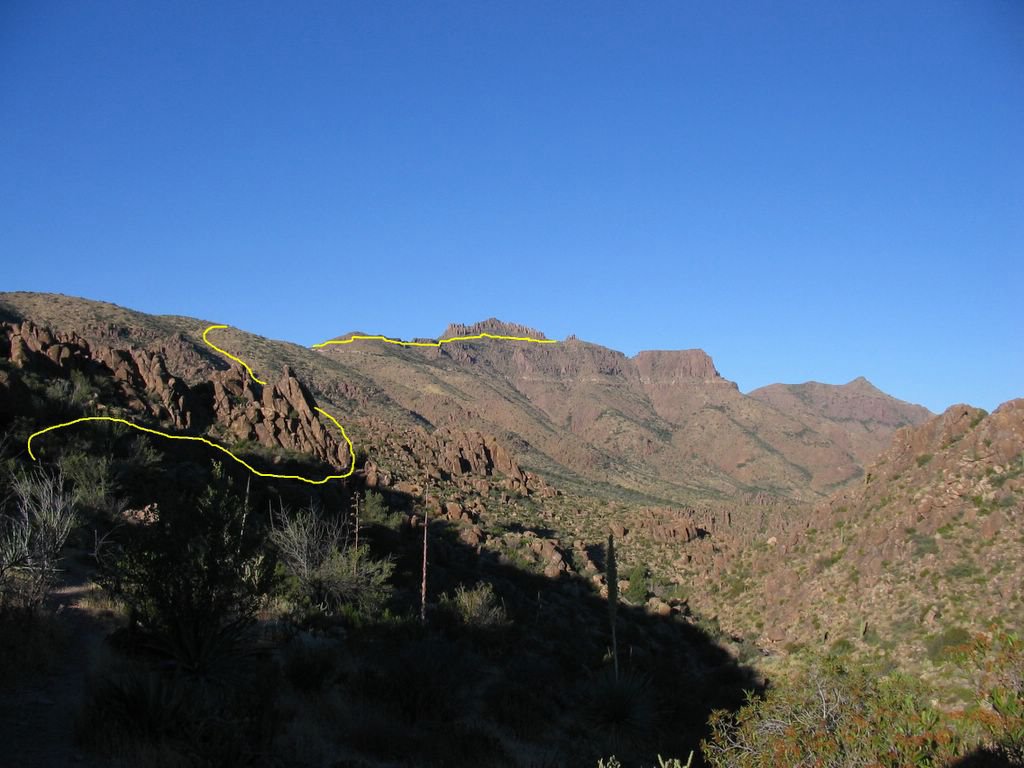
We actually missed the peak and skirted to a saddle between the peak and a lower set of hoodoos - to backtrack and hit the peak itself would have taken too long, and all of us had been on top before, so we decided to skip it. This shot is looking east away from the peak looking towards the Flatiron area.

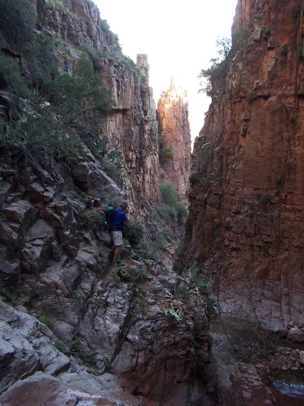
You do some pretty interesting and difficult climbs getting off of the peak, and looking back it's sort of hard to tell exactly how you did it. Even with the trail marked it still doesn't look safe.

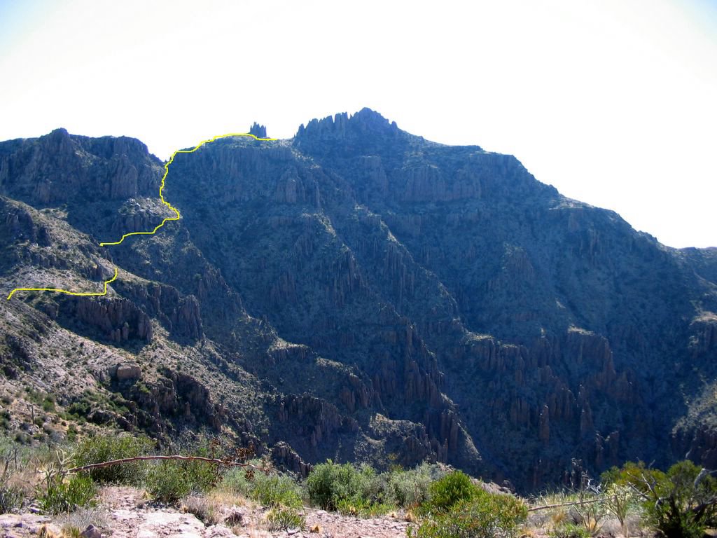
Here we are near the "end" - really just nearing the familiar territory that is the Flatiron/Siphon Draw trail. Looking back over the way we came, that peak way back there is Superstition peak. We're about 3/4 of the way through the hike at this point.

Ahh...the familiar site of the insane descent that is the Flatiron/Siphon Draw trail. Keep in mind that you've already hiked nearly 9 miles and your legs are feeling like jell-o - and that descent is no picknick even if you're fresh.

Good times.

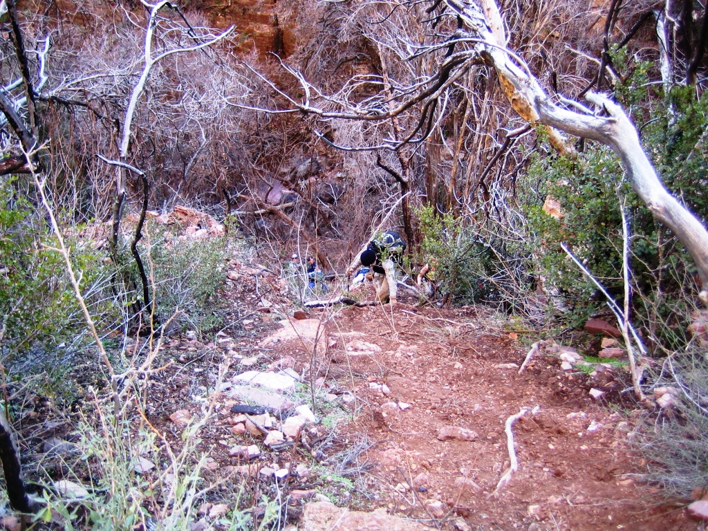
Finally, we're down at the end of the Siphon Draw trailhead and entering the home stretch - no more steep downhill climbs, just sliding along all the loose rock and gravel for another mile or so.

Did I mention that your legs feel like jell-o at this point?

That arrow is pointing to the campground area - our final destination.

That's what we just did. Well, that's the Flatiron/Siphon Draw trail anyway - the rest of the trail is all behind the mountain.

Finally I can enjoy the ice-cold Gatorade from the cooler in my car. Thankfully we had a wonderful support crew that came and picked us up and drove us back from the trailhead the last 1/4 mile or so to the campsite.

Like I said - a fine day of hiking.

This is a panorama view from just below the peak looking north and sweeping east.

Another panorama view from just before the final stretch looking north and sweeping east. You can spot Weaver's Needle in both panoramas if you know what to look for - it sure doesn't look the same from the backside.


It will take me at least 1 week to recover from this hike, but it's totally worth it.

Monday, March 28, 2005

The desert in bloom

The post immediately prior to this one was of a trip I did to the Siphon Draw/Flatiron trial 2 weeks ago (3/12/05). A friend of mine had never done the trail before and wanted to go - so, being the generous person I am, I offered to be his guide for the day.

I'm just nice like that.

Anyway, the Superstitions were even more awash in color than 2 weeks ago. It was spectacular. So, without focussing to much on the actual trail, here is a photo essay of spring flowers in the desert.

We left at sunrise so the flowers weren't out at the bottom of the mountain, so the images will roughly go from the top of the mountain down.

Near the top of the mountain you saw a few of these little fellas:

Apparently called the Desert Penstemon. They weren't very common, but they sure brightened up the area when they appeared.

Also at the top we saw a few Wooly Daisies.


Usually near the daisies were some Eaton's Firecrackers

We were even lucky enough to see a few hummingbirds out and feeding on them.

Another very pretty but not terribly common flower we saw was the Doctorbush. A very pretty, and very delicate looking flower.


As you get closer to the bottom of the mountain, you start to see the intensity and amount of flowers increase. It turns into a real bonanza of color.


Lots of little purple flowers (these, I think) start popping up in the undergrowth.

Then things start to get interesting. You start seeing sights like this:


And this:


Where these and these start cropping up.
Now the dominant flower becomes the Brittle Bush.


Then, these wonderful purple flowers start to appear, the Mojave Lupine (similar in look to a Bluebonnet flower for you Texans out there).

When they start to appear you get to see things like this:


The last thing to appear as you descend the mountin are the California Poppies.

They're just such a happy little flower.


Some other flowers that I saw, but was unable to get a descent picture of can be seen here and here.

Following the wet winter, this year has lived up to the hype.

The brittle bush have just reached their peak, so the base of Superstition is a lovely gold in color:


The poppies are starting to thin out a little, but I managed to catch them at their peak (2 weeks ago). And now is about the best overall mix of flowers you could hope for.

My next trip is to go and see the Hedgehog and Prickly Pear cactus in bloom - that should happen in the next 2 or 3 weeks.

After all this blooming following a near decade long drought, the best thing in the world would be to have another wet winter next year. That scenario would provide one of the greatest spring blooms of all time.

I get excited just thinking about it.

Wednesday, March 16, 2005

Siphon Draw / Flatiron in spring 3/12/05

I had the pleasure of going out for a solo hike up the Siphon Draw trail to the top of Flatiron. It was a beautiful spring morning, the weather was cool and the air clear. I haven't hiked solo in so long that I had forgotten how truly liberating it can feel.

Not only was the weather great, but the desert was as green as I've ever seen it. The picture below has the lighting adjusted up since it was taken before sunrise, but you get the idea of just how green it was out there.


I'm farily certain you can only truly appreciate the wonder of that photo if you're from the desert.

In the middle portions of the trail you got to see something that is quite a rare site: Miner's Lettuce


It only grows in shaded areas around the 4,000 ft level, and only when it is nice and moist. And we've certainly had moist conditions this winter.

If you're familiar with the Siphon Draw trail, you certainly won't recognize this:


That's how green it is out here this year. That section of the trail is usually just a few bushes. You can't even see the rocks.

Of course, the real reward is the spring flower show:


The desert isn't in full bloom yet, but it will get there in the next few weeks. And when it does, the whole desert floor will be covered with poppies:


The desert in spring is always a beautiful thing - but the desert in spring after a wet winter is a treasure beyond price.

Tuesday, February 15, 2005

Devil's Chasm - 2/12/04

We did this hike with a group of about 12 people. Only 2 had done the hike previously and they served as our "guides." I put guides in quotes only because the trails were so hard to locate and so rugged that we were basically picking our way throught the terrain based on guesswork and the occasional cairn placed in particularly difficult spots.

Overall the hike was absolutely spectacular. We've had an unusually wet winter so there was lots of water flowing down falls, streams, seeps and so forth. The trail was quite sloppy with mud in a few places, but that kind of added to the fun cause you don't get to hike in the mud very often in Arizona.

The last 1/4 of the hike was the most brutal. The total distance is just over 2 miles in - but it took us 4 hours. The last ascent before you reach the ruins is the worst portion of the trail and the most difficult portion of the hike, and that's what is on display in the picture I included at the start of this set. The goal of the trail made it all worth it though.

There is a very special feeling you get when you reach remote and isolated locations with striking beauty such as we found that day. The feeling of seeing something that not many people will ever get to see, and the general communing with nature in a relatively unspoiled area.

Good friends and good trails make for a great day.


This is a view of what a good portion of the trail looks like on the way into the ruins. Yes, that is someone standing on the cliff, and yes, we all had to traverse that section of the "trail." Although, to be fair, it didn't feel quite as hairy as it looks.


Honestly - who in their right minds hikes stuff like this willingly? Look carefully - there is one gentleman on the right about 3/4 of the way to the camera, then WAAAY at the bottom are 2 more people just beginning the ascent.


This is what we're trying to get to. You honestly cannot catch one single view of the ruins till you are right where I took this picture. At this point you're about 200 yards away.


Isn't it beautiful? Look at that spectacular curve to the front wall matching the cliff face.


It looks a little bigger on the outside than it really is - apparently these folks weren't very tall.


And they liked to live on the edge. Literally.


The site is plundered pretty badly. People have even taken the support posts out of the walls.


But there are still a few artifacts left behind.


And if you look closely you can still see the imprint of the hands that built this wonderful structure around 6-800 years ago.


Looking into the doorways to the past.

There were 4 rooms still standing in the structure. 3 were "inside" and one was on the front edge, but the walls were pretty damaged so it was much more open to the elements. That picture is taken from the open room looking through to the other 3.

The view from the back porch was asl pretty spectacular. Those native Americans sure knew how to pick a spot. Apparently the whole area is just littered with ruins. I'm planning on heading back to try and spot some more.

Monday, February 14, 2005


Just hangin' out with the boys.

Thursday, January 27, 2005

The beginning

I do a lot of hiking, and I wanted somewhere to post the pictures from my hikes where everyone could view them. I have other places where photos are stored, but they aren't public doman (registration required).

Anyway, I hope you enjoy looking at the beauty I see in the desert where I hike.

If you want to see some photos by other, more tallented, photographers who find the desert beautiful, spend some time and log into arizonahikers.com (registration required), or hikearizona.com (also requires registration).